West Hill Road - Wallingford, VT
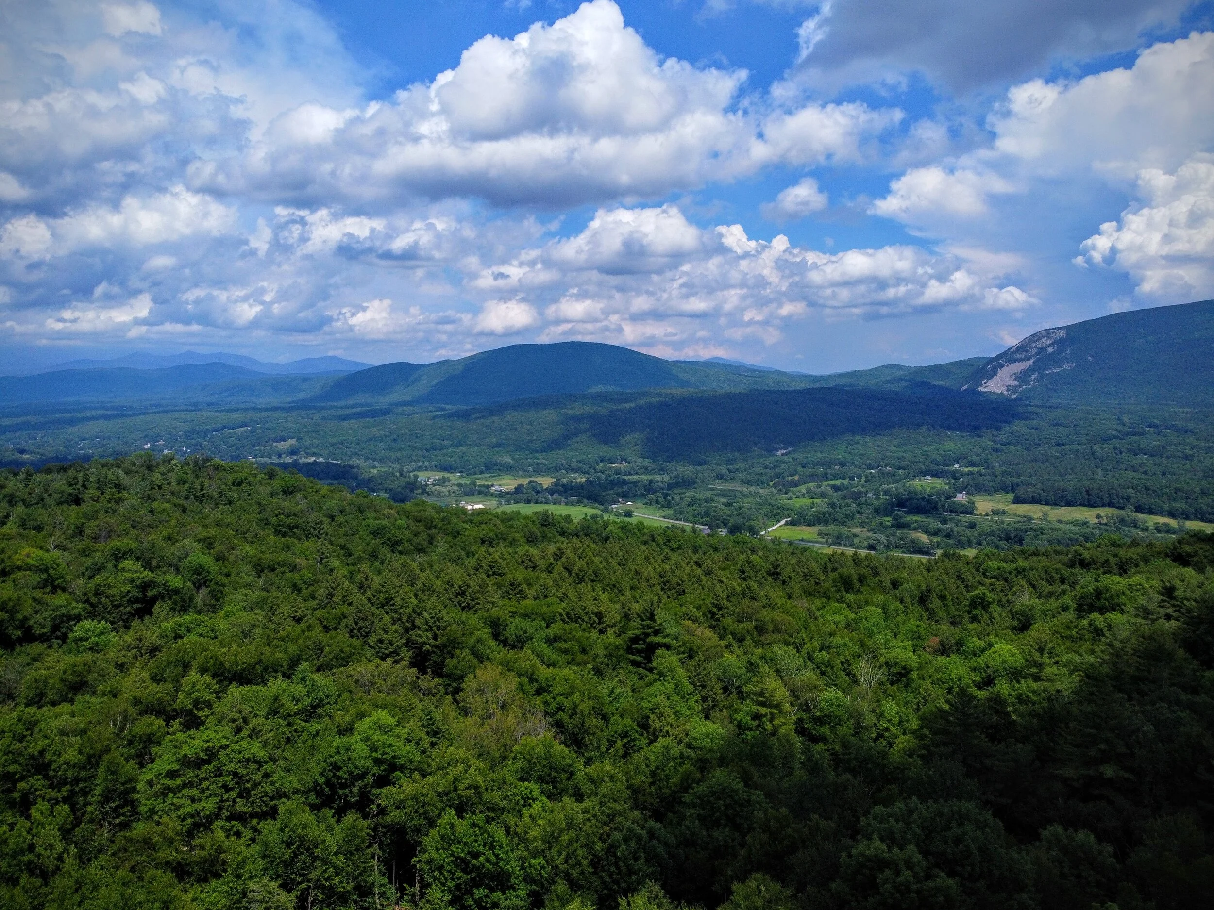
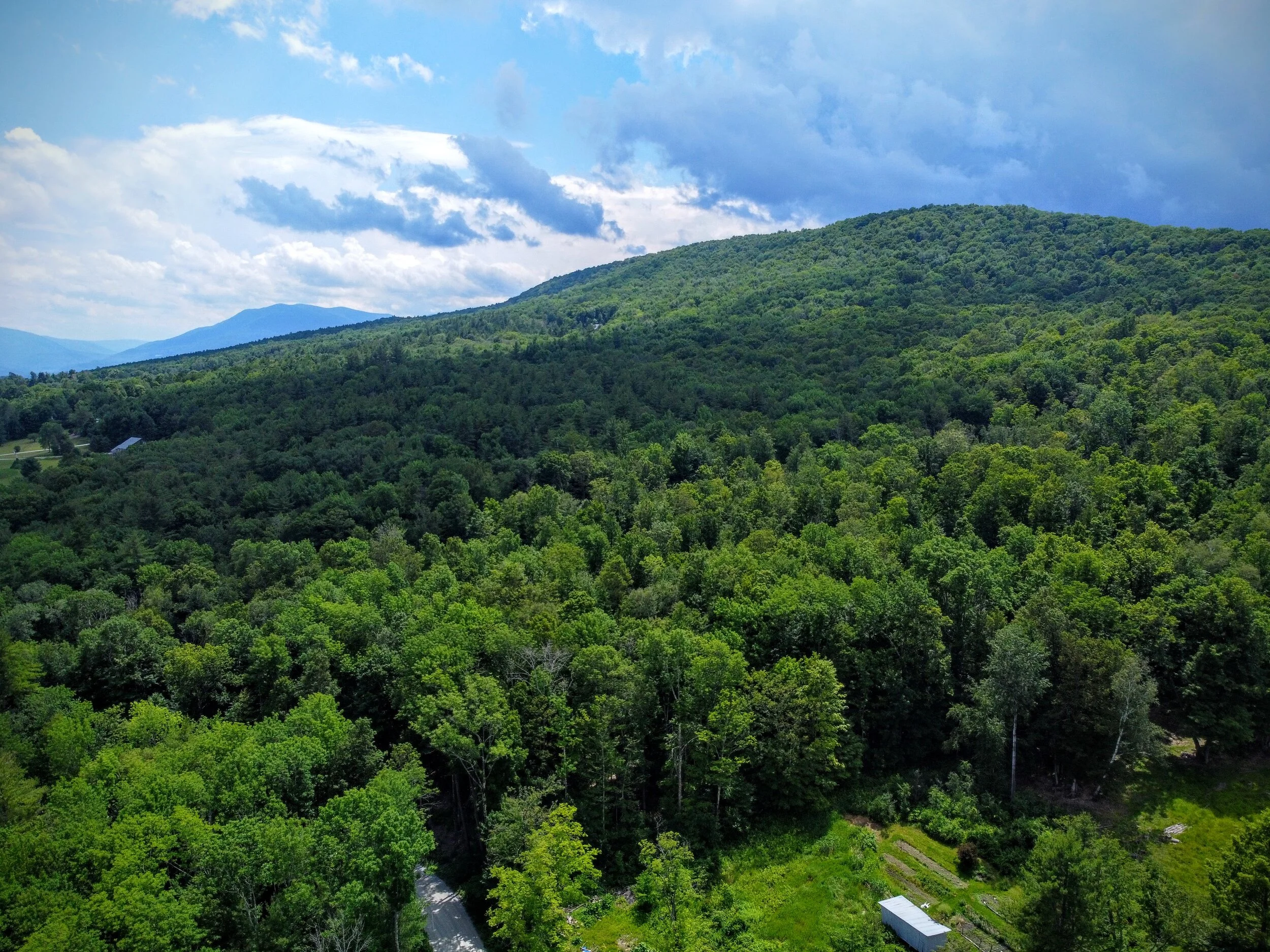
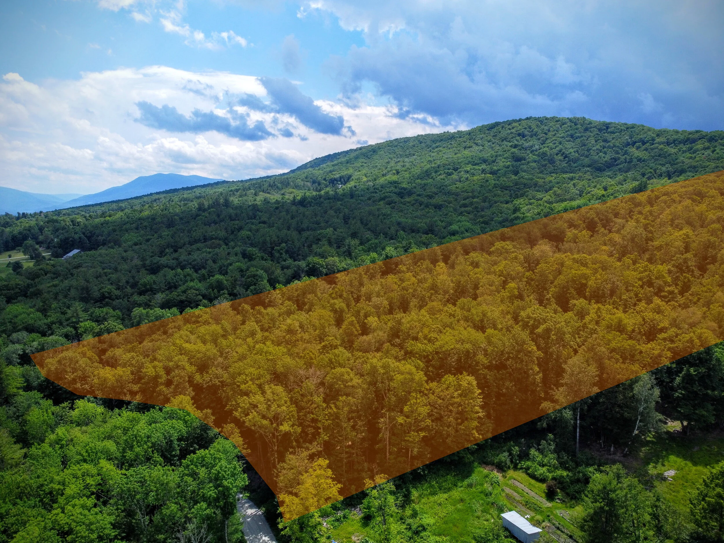
Spanning more than 96 acres in two zip codes, this awe-inspiring property features meadows, trails, untouched woods, and a perennial creek fed by a natural spring. Ascending gently from over 1,500 feet of frontage on West Hill Road, the entire eastern face is exposed to a magnificent view of the surrounding mountains and valleys—particularly the iconic White Rocks formation, a National Recreation Area known for its granite cliff, huge rockfall, and 30-mile section of the Appalachian Trail.
From there the topography rises even further, all the way up and over the northern ridge of Clark Mountain, with a potential 360-degree view from the top.
Wallingford itself is a quintessentially adorable Vermont town, yet every modern convenience is just ten minutes away in Rutland, including medical facilities and even a regional airport. And of course... this is the very heart of ski country, with resorts in nearly every direction—literally! It's 20 minutes east to Okemo, 30 minutes north to Killington, and 45 minutes south to Stratton and Bromley.
With ample maple trees for tapping, larger pines for harvesting, trails for hiking or riding, and of course plenty of acreage for a tasteful estate or spacious subdivision, opportunity abounds on West Hill Road.
Asking Price: $360,000
Size: 96.3 acres
Address: West Hill Road
Town: Wallingford, VT 05773
SPAN (Lot 1): 681-216-11192, ID 0050420, Wallingford, VT
SPAN (Lot 2): 645-203-10419, ID 0WAL0003.000, Tinmouth, VT
Property Tax (2020): $2,315.76 per year (Wallingford side)
Coordinates (northeast corner):43°27'01.1"N 73°00'25.3"W
Coordinates (southeast corner):43°26'44.3"N 73°00'20.3"W
Google Maps Link (northeast corner):https://goo.gl/maps/oK5qif7qhuhaagbj9
Google Maps Link (southeast corner): https://goo.gl/maps/h3a6MQKo8XMWR8pp7
Zoning Ordinance (Mostly Agricultural & Rural Residential, Some Forest & Recreational): https://www.wallingfordvt.com/wp-content/uploads/2014/07/Zoning-Regulations-Adopted-8-17-151.pdf
Wallingford, VT Zoning Map: https://www.wallingfordvt.com/wp-content/uploads/2014/07/wal-zoning-6-2015F-Map.pdf
Access: 1,600 ft. of frontage on a town-maintained road
Association Dues: n/a
Terrain: Wooded, gentle slope, mountain ridge
Disclosure: Listing presented by contract-holder of the parcel described. Said contract is advertised herein.