

Piper Road - Weathersfield, VT
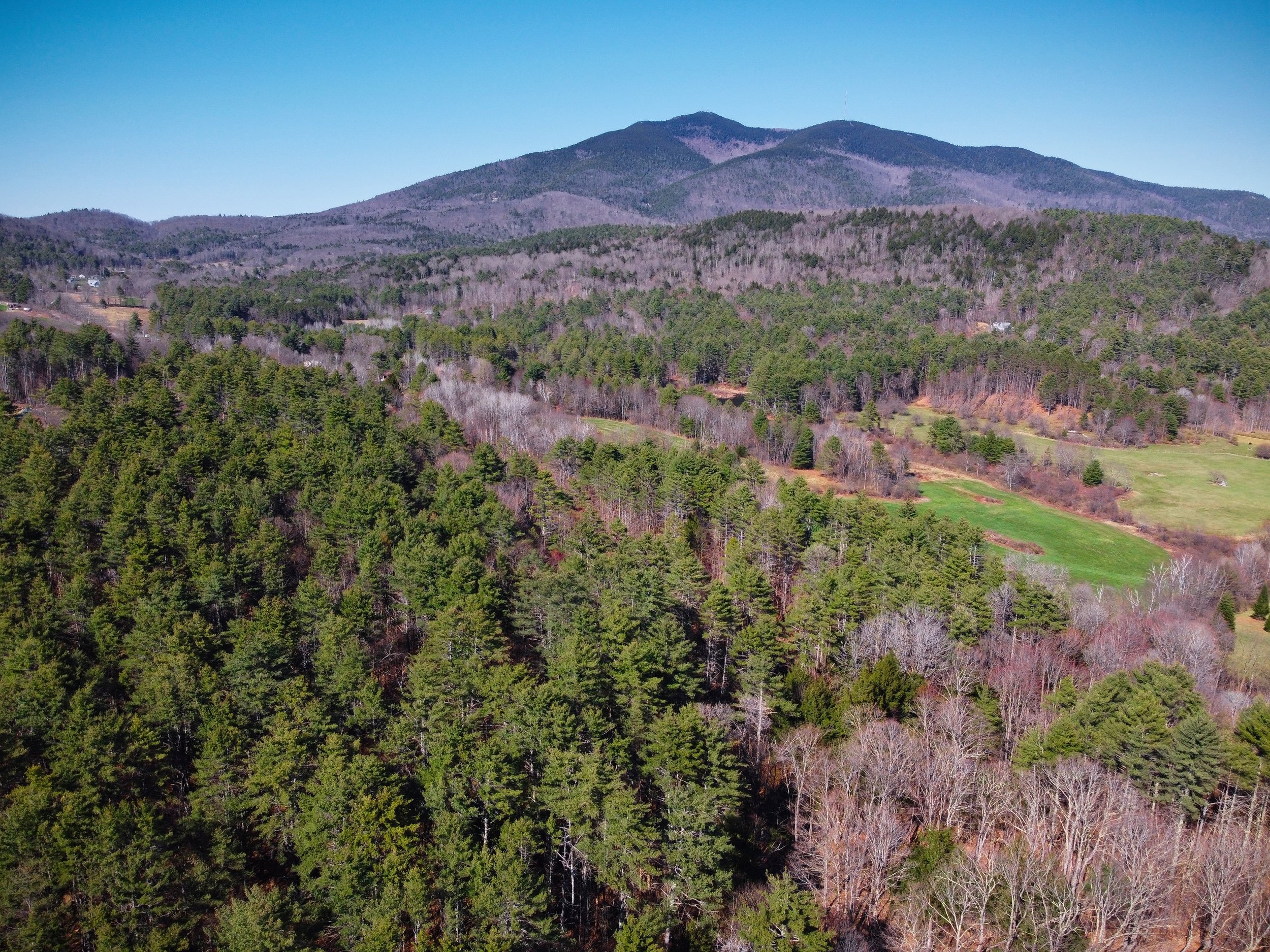
Magnificent oversized building lot with room for two homes and potentially spectacular views of Mt. Ascutney or Little Ascutney, or both!
Ascutney summit spikes up prominently from the valley floor northeast of this property. After tree work the view will be a straight line over picture-perfect Vermont farmland across the road. Alternatively, you could build on the west side of the property's central ridge, facing northwest toward Little Ascutney, with its plunging cliff that some people find even more dramatic as a focal point.
A detailed soil investigation encompassing 16 test pits found there is sufficient soil for not one but two mound-type septic systems here, making this a very exciting subdivision opportunity.
The southern border of the property is the midpoint of a VAST snowmobile trail. It may be possible to construct part of your driveway over the existing trail, cutting down on expense and impact, and preference will be given to buyers that intend to continue sharing the land with VAST. Otherwise, the second-best driveway location would be just north of the trail, following it over a small creek. An engineering report and delineation shows a culvert crossing over the creek is feasible, and we have written remarks from the county wetlands reviewer confirming the crossing appears reasonable to permit.
This location is 8 minutes from I-91 with fast access to the entire length of Vermont.
To view follow Piper Road to the coordinates below. The front corners are marked with red flagging tape. At the southeast corner, follow the VAST trail on foot along the southern border until it forks. Take a right and follow that part of the trail to view the western side of the property.
Asking Price: $88,000
Size: 12.15 acres
Address: Piper Road
Town: Weathersfield, VT 05151
SPAN: 705-224-11693
Property Tax (2023): $1,401.20
Coordinates: 43.412505, -72.490631
Google Maps Link: https://maps.app.goo.gl/Xz8AcsaMTAUsV7mT9
Perc Test: Detailed soil investigation including percolation tests available. Up to two mound systems feasible.
Water Supply: Well needed.
Survey: Survey available.
RV Potential: Travel trailers, campers, pick-up campers, and motor homes owned by the landowner or their non-paying guest may park on the property and be used as temporary living quarters for periods of up to four weeks.
Zoning Ordinance (Rural Residential Reserve District):https://www.weathersfieldvt.org/sites/g/files/vyhlif6216/f/uploads/weathersfieldzoningbylaws.pdf
Access: Approximately 567 feet of frontage on Piper Road.
Association Dues: n/a
Terrain: Heavily wooded. Generally flat near the road, bisecting by a creek running north to south. After the creek, topography rises to the west to a high wide ridge running north to south. West of the ridge topography begins to slope gently down toward the western border.


